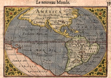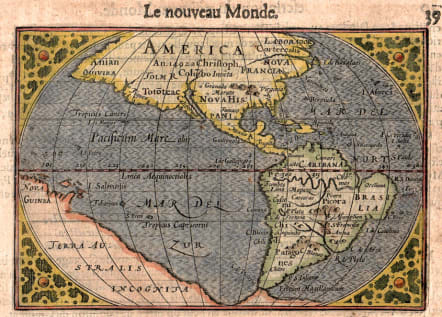
AMERICA
£450
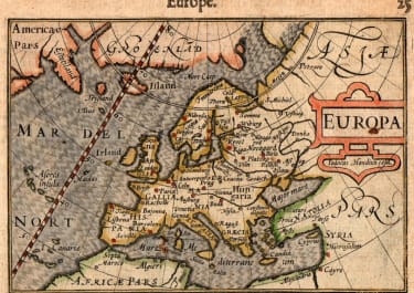
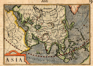
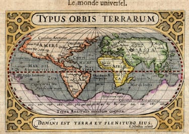
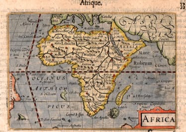
Rare and early depiction of the Americas, created by Barent Langenes and published by Cornelis Claesz in the French edition of the atlas Thresor de Chartes, contenant les Tableaux de tous les Pays du Monde (Treasure of Maps, containing the Maps of all the Countries of the World). This particular map was engraved by Petrus Kaerius (also known as Pieter van den Keere) and published in The Hague in 1600.
It reflects the geographical knowledge of the Americas at the time, which was still evolving as European explorers continued to chart the New World.
Early maps of the Americas, especially those from the late 16th and early 17th centuries, are highly sought after by collectors and historians.
The combination of Langenes' cartography, Claesz's publishing, and Kaerius's engraving makes this map a significant piece of early cartographic history.
The mapt would be a valuable addition to any collection focused on early Americana or the history of cartography.
good hand colour
Very good condition
Published by Cornelis Claesz in French edition atlas Thresor de Chartes, contenant les Tableaux de tous les Pays du Monde” engraved by Petrus Kaerius in Den Haag, 1600.
References: Van der Krogt 3, 9000:341; Burden, #92 State 1; Church America, #251; Wagner, #195
code : M5450
Cartographer : LANGENES Barent
Date : 1598 / 1600 Hague
Size : 8.5*12.5 cms
availability : Available
Price : £450
Barent Langenes
Langenes was a publisher in Middelburg about whom little is known except that he produced the first edition of a very well known miniature atlas, the 'Caert-Thresoor'.
The atlas was published by Cornelis Claesz in Amsterdam, the foremost publisher of the day. The copperplates were engraved by brothers-in-law Jodocus Hondius and Petrus Kaerius, the most skilled engravers of the day.
The Caert-Thresoor
The Caert-Thresoor, a small atlas of the world in oblong format, appeared in 1598; thereby, its publishers wrote a new page in the history of atlas cartography. The preparations for this prototype of the new generation of Dutch pocket atlases began around 1595. At that time, Cornelis Claesz commissioned the skilled engravers Jodocus Hondius and Pieter van den Keere to engrave the maps. An unnamed young writer and poet - in Burger's opinion, it was Cornelis Taemsz of Hoorn - was called upon to write the accompanying text. Claesz wanted his Caert-Thresoor to outshine the similar small world atlases that had been produced thus far in Antwerp. In this way, he set out to spark interest in and knowledge of geography among the public at large in the Northern Netherlands. In view of the various reprints, editions, and adaptations of this work in Dutch, French, and Latin, obviously the Amsterdam publisher was quite successful in that endeavor.