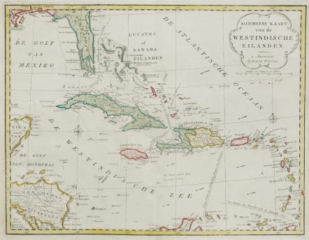
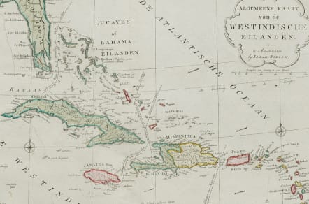
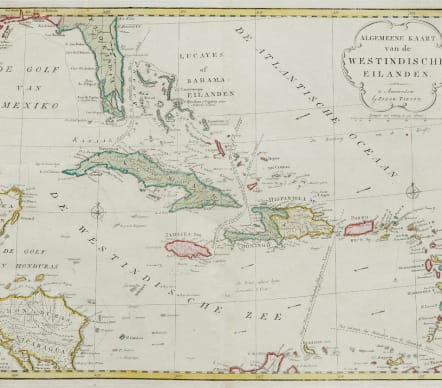
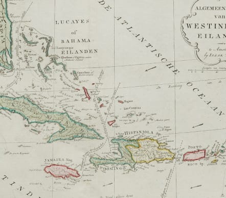
WEST INDIES ALGEMEENE KAART VAN DE WESTINDISCHE EILANDEN
£375
Very good original hand colour chart of the West Indies by Tirion. This chart of the Caribbean, also shows part of Florida, the Yucatan, and Central America. Even small islands are well-represented and navigational hazards are marked. Major sea routes are noted as well as the direction of the prevailing winds. Title cartouche and two compass roses decorate the chart. Engraved by J. Condet.
Original hand colour
Mint condition
Publication, Nieuwe en Beknopte Hand Atlas
References: Shirley (BL Atlases) G.TIR-1a #19.
code : M5177
Cartographer : Isaac TIRION
Date : 1753 Amsterdam
Size : 35*45cms sheet 41*47.5 cms
availability : Available
Price : £375
Isaac Tirion (c.1705-c.1769) was born in Utrecht. He became a prominent bookseller and publisher with premises on the ‘Kalverstraat’ in Amsterdam and was also to become a member of the board of the booksellers’ guild. He was responsible for a large number of atlases and books with maps.