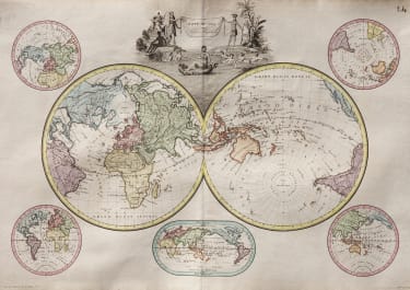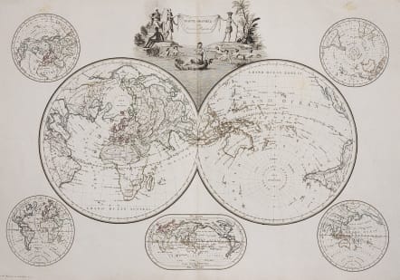
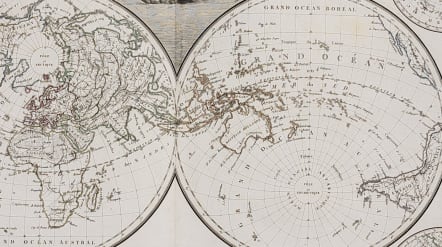
MAPPE-MONDE SUR DIVERSES PROJECTIONS
Sold
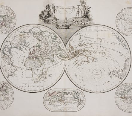
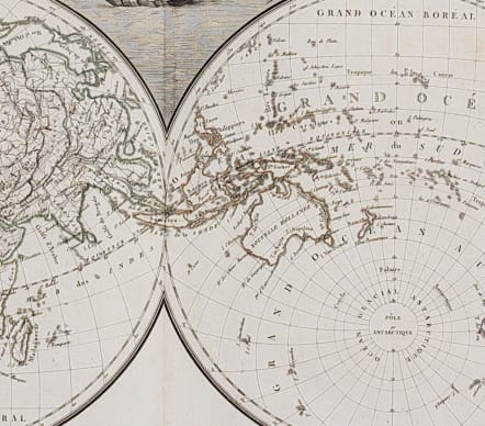
Very attractive copper engraved, double hemisphere map centered on South East Asia, and featuring the topography rather than political divisions. Five other projections surround the map; northern, southern, western, eastern and Mercators. Pictorial title cartouche with the four female representations of the continents, Venus in a seashell, and frolicking mermaids.
Engraved by Chamouin.
Original outline colour
Very good condition.
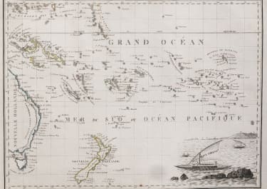
***Australia ..
This map is one of the first maps to show the area of southern Australia and Spencer’s Gulf. Though it was Mathew Flinders who was the first to map this region it was the French explorer Baudin who made it back to Europe first and so this map shows Spencer’s Gulf as Bonaparte’s Gulf, which was in honor of Napoleon who was at the time successfully invading much of Europe. Flinders unaware of the French/English tensions that had intensified in the early 1800’s stopped in for supplies on an island off the African coast and was subsequently arrested and held for many years on the island. When he finally returned to England he published his discoveries, which was some 10 years later in 1814 and shortly before his death. The gulf was then officially renamed Spencer’s Gulf in recognition of its discovery first by him.
code : M3859
Cartographer : LAPIE Pierre
Date : 1812 Paris
Size : 33*47 cms
availability : Sold
Price : Sold
Pierre M. Lapie (fl. 1779 - 1850) and son Alexandre Lapie (fl. 1809 - 1850) were French cartographers and engravers active in the early part of the 19th century. Lapie (Pierre), cartographer, born at Mezieres in 1771, died in 1850, was admitted in 1794 to the corps of topographical engineers, in that capacity he made several campaigns, rose to the rank of Colonel of Staff, and in 1814 became director of the topographical cabinet of the king, was, from 1818 he was responsible for the direction of the new topographic map of France, and had the greatest part in the execution of this magnificent work. He published a classic Atlas (1812), which was improved in several successive editions, and a Universal Atlas of Ancient and Modern Geography (1828), one of the best of his era.