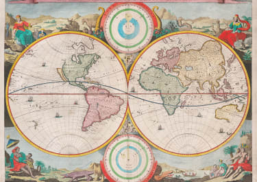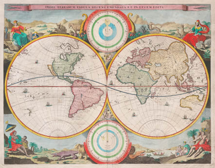
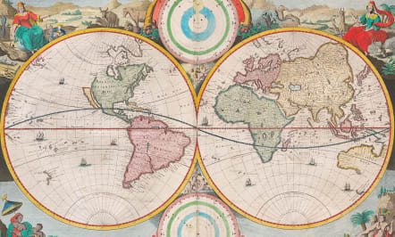
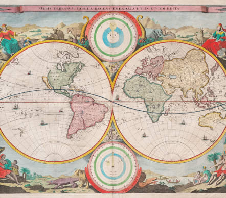
WORLD ORBIS TERRARUM TABULA RECENS EMENDATA ET IN LUCEM EDITA
£1400
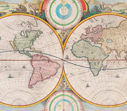
Attractive scarce Keur double hemisphere map of the World, based upon Nicolas Visscher's map of 1658.
The Keur family produced a number of different bibles from their press at Dordrecht and later at Rotterdam. This finely executed general map in two hemispheres is beautifully decorated.
The corners are illustrated with female allegorical figures representing the four continents in appropriate settings. The figure of America is represented as an Indian princess.
The northern part of California (as an island) is flat, based on Briggs model. A small piece of land Anian appears adjacent to a strait leading within striking distance of the west shores of Hudson's Bay.
Excellent hand colour.
Very good condition
Reference
Shirley, 513.
code : M5480
Cartographer : Nicolaas VISSCHER
Date : 1682c Dordecht
Size : 36*46.5 cms sheet size 42.5*48.5 cms
availability : Available
Price : £1400
Among the many great Dutch map publishers active in the seventeenth century were the Visscher family; the firm was begun by Claes Jansz Visscher (1587-1652), and subsequently included his son Nicolaas (1618-1679), grandson Nicolaas II (1649-1702) and then his grandson’s widow, Elizabeth, until her death in 1726.
Although mainly art dealers, the Visschers were prolific publishers, producing individual maps and also atlases made up to their customers’ specifications. Indeed, they are commonly regarded as second only to the Blaeus among Dutch map-makers for the high quality of engraving and decoration and the geographical accuracy of their many maps. Particularly outstanding - not only as maps but as works of art - are their world maps.