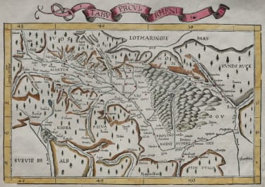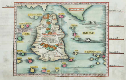
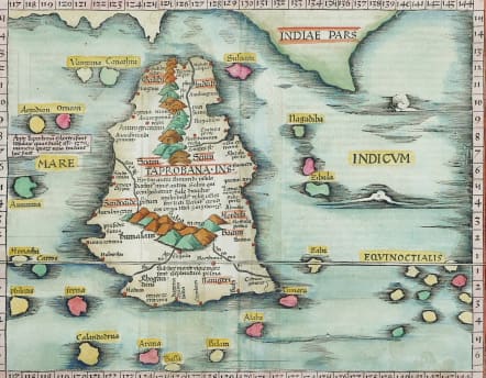
TABULA XII ASIAE
£595
Antique Map of Ceylon Sri Lanka ;
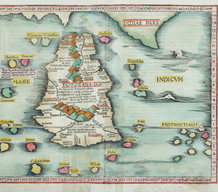
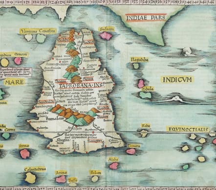
Important early modern map of Taprobana, from Fries's 1525 edition of Geographia.
This is an early woodblock map of the island of Taprobana, which depicts the typical misconceptions of Ptolemy showing the island greatly enlarged, surrounded by imaginary islands, and with a small part of India incorrectly drawn in the northeast corner of the map. Taprobana was drawn too large on most early maps due, in part, to its importance to trade between the Europe and Southeast Asia. Also, Marco Polo stated that the island had a circumference of 2400 miles and had been even larger in the past.
This map is largely based on the 1513 map by Waldseemuller, with the addition of more of the spurious Indian coastline and more small islands to the east of Ceylon. The title is on the verso along with Latin text and elaborate ornamental border, thought to be the work of Hans Holbein and Graf of Basel. The editor of this Latin edition, Michael Villanovus (better known as Servetus), was subsequently tried for heresy and burned at the stake in 1553, ostensibly because of derogatory comments in the atlas about the Holy Land.
Text image from verso just shows
Excellent hand colour
Good condition
From: L. Fries, Opus Geographiae. Strasbourg, J. Grüninger, 1525. (Karrow, 28/G.1; Shirley (Brit. Lib.), T.PTOL.7b))
References: Karrow - 28/27
code : M5287
Cartographer : Fries Waldseemuller Ptolomy
Date : 1525 Strasburg
Size : 29*45 cms sheet 38*50.5 cms
availability : Available
Price : £595
Early Ptolomaic map publishers and cartographers