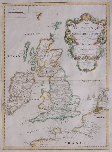
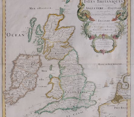
CARTE DES ISLES BRITANIQUES
£
Full Title Carte des Isles Britaniques où Sont les Royaumes d'Angleterre, et d'Escosse, que nous appellons Grande Bretagne et celui d'Irlande..
A map from the rare Atlas Cartes de Geographie by Pierre Du Val (1619-83) son-in-law of Nicolas Sanson, ( Duval published a wide range of atlases, individual maps of the world and the continents and wall maps but most of the folio maps are rare.
All the maps from this edition are revised and updated maps.
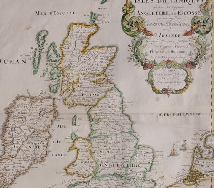
Original outine colour with added later hand colour on cartouche.
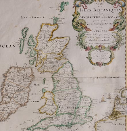
The title is within a rococo cartouche; off the East Anglian coast is a vignette sea-battle, representing the Anglo-Dutch Battle of Lowestoft of 1665, the year this map was published.
Extra flattened fold
Otherwise good condition for this rare map.
Shirley records this map of the British Isles as a separate publication, however I now know that it comes from a composite atlas and although this map is dated 1665 it comes from a 1676 edition.
SHIRLEY: Printed Maps of the British Isles, pp. 53 - 54. State 1.
RESERVED
code : M4745
Cartographer : DU VAL Pierre
Date : 1655/ 1676 Paris
Size : 35*48cms
availability : Available
Price : £
Pierre Du Val (1619-1683) was one of the most influential and prolific mapmakers and publishers working in Paris in the third quarter of the seventeenth century. He was the nephew of Nicolas Sanson, the leading French mapmaker of the period, and Geographer to the King of France from 1650. He was also responsible for providing maps for other Parisian editors of the period; Jollain, de Fer and Berey amongst others.