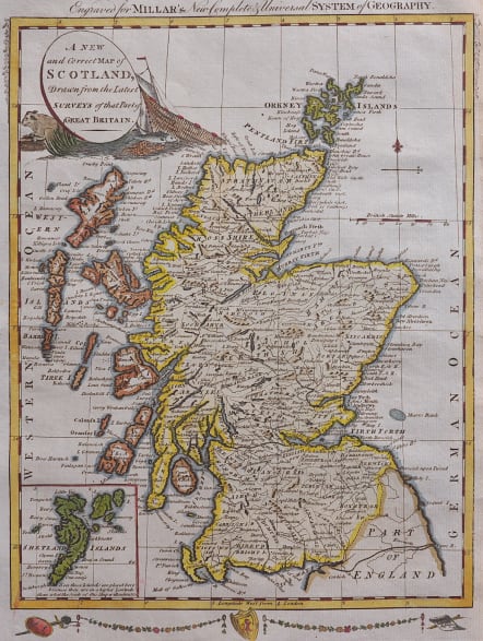
A NEW AND CORRECT MAP OF SCOTLAND
Sold
Full Title A new and correct map of Scotland drawn from the latest surveys of that part of Great Britain
Uncommon map published in Millars New Complete and Universal System of Geography 1782. Decorative border below map. Cartouche with local produce fish and beef and a fishing boat and net.
Inset of Shetland Islands.
Excellent hand colour
Very good condition
code : M4761
Cartographer : KITCHIN Thomas
Date : 1782 London
Size : 30*22.5 cms
availability : Sold
Price : Sold
Thomas Kitchin (1718-1784) was one of the best and most prolific engravers of the eighteenth century. He issued The General Atlas, Describing the Whole Universe , first published in 1773, and regularly reissued thereafter. His work also included a large number of maps of the English counties, particularly for the London Magazine (1747-1760), the Universal Magazine (1747-1766), and for Dodsley’s England Illustrated (1764). Other maps were published in conjunction with Emanuel Bowen in the Large English Atlas and the Royal English Atlas (1763).