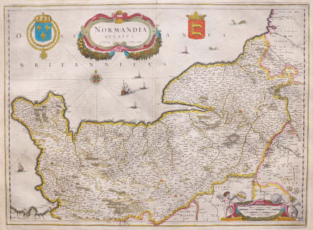
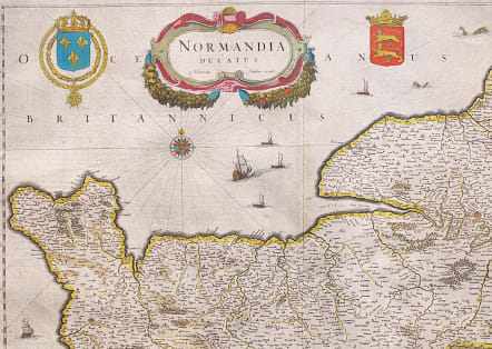
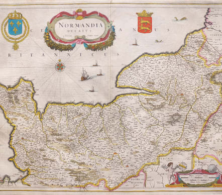
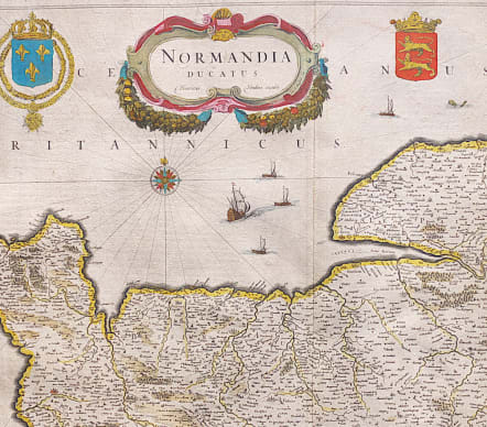
NORMANDIA DUCATUS
£265
Stunning map of Normandy by Janssonius although on this early publication Hondius' name is still on the map, It was changed on later editions to Janssonius.
Highly decorative with Cartouches, Heraldic devices,Galleons and sea monsters.
Interestingly enough and contrary to most descriptions of this map the engraver was one Cornelis Claesz Duysend and his name can be found in tiny script in the title cartouche.
Excellent original colour
Near mint condition.
http://www.britishmuseum.org/research/search_the_collection_database/term_details.aspx?bioId=176165
code : M3633
Cartographer : JANSSONIUS Johannes Jansson
Date : 1638 Amsterdam
Size : 39*53 cms
availability : Available
Price : £265
Johannes Janssonius Jr. (1588-1664) was the son of the bookseller and publisher, Johannes Janssonius of Arnhem (ie. Janssonius, the elder). The elder Janssonius of Arnhem acted as co-publisher, with Cornelis Claesz, of the early editions of Hondius' "Atlas Minor".
Janssonius Jr. married Jodocus Hondius' daughter Elisabeth in 1612. From about 1633 onwards Janssonius' name and imprint started appearing on the Mercator/Hondius "Atlas ..." After 1636 the name of the "Atlas ..." was changed to "Atlas Novus "with Janssonius being responsible, in the main, for its publication.
The "Atlas Novus" was expanded by Janssonius over the years of its publication in an attempt to rival Blaeu's "Atlas Maior" for size and quality. Janssonius' "Atlas Novus" eventually comprised six volumes with a nautical atlas and an atlas of the ancient world included. The maps were relatively similar format to those of Blaeu, although a difference in style is certainly discernible.
Janssonius also issued an "Atlas Maior" of his own, again in competition with Blaeu, but this was not issued as regularly as the Blaeu version. The "Atlas Maior" comprised some ten volumes - eleven if the Cellarius celestial volume is included.