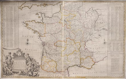
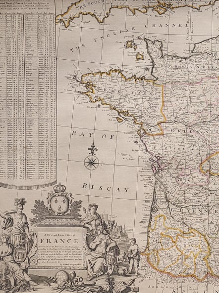
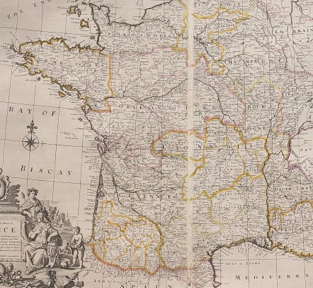
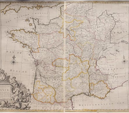
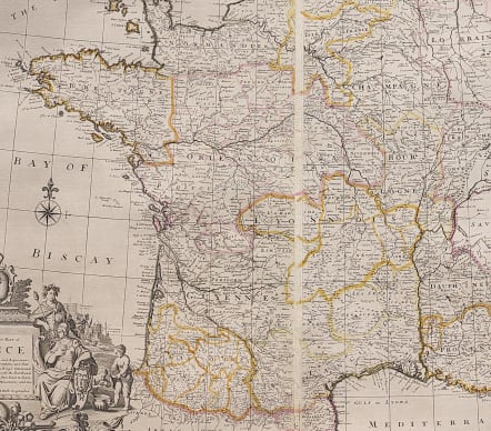
A NEW AND EXACT MAP OF FRANCE DIVIDED INTO ALL IT'S PROVINCES AND ACQUISITIONS ACCORDING TO THE NEWEST OBSERVATIONS
£450
Rare and very attractive important map of France by Moll.
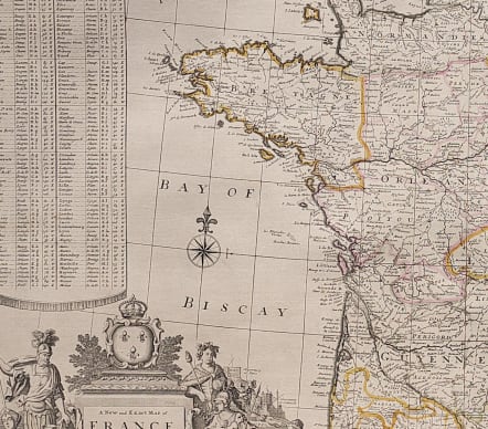
Separately issued map depicts France's network of post roads and includes alphabetical tables showing the ''Principal Towns of France &c and their Distances in Leagues from Paris.'' It also lists the 32 ''Ports of Passes of the Pyrenean Mountains''.
V Attractive cartouche with the arms of ''France Moderne'' (three fleurs-de-lis on an azure field), and supported by the gods Ares and Dionysus, and the goddesses Artemis and Athena. The landscape depicts putti harvesting grapes, while a town, a vineyard, and the astronomical observatories at both Greenwich and Paris are visible in the background. On display in the foreground are objects symbolic of agriculture, industry, exploration, and war.
Original outline colour
*** This map has a provenance of being in the private collection of Dr Helen Wallis (1924-1995) map librarian at the British Library.**
Backed on linen to museum standared.
Overall a superb map in v good condition with a fine provenance
code : M3821
Cartographer : MOLL Herman
Date : 1720c London
Size : 61*98 cms
availability : Available
Price : £450
Herman Moll (1654? - 1732) was an important 18th century map publisher and engraver based in London and Holland
He moved to London in 1680 where he worked as an engraver for Moses Pitt, among other London map publishers. Around the turn of the century, Moll set up his own shop where he produced a large corpus of work known for its high quality and decorative flair.