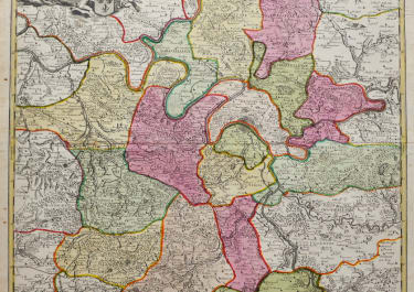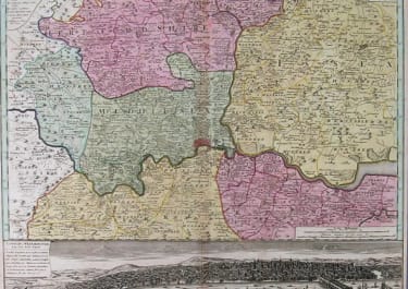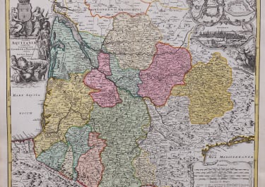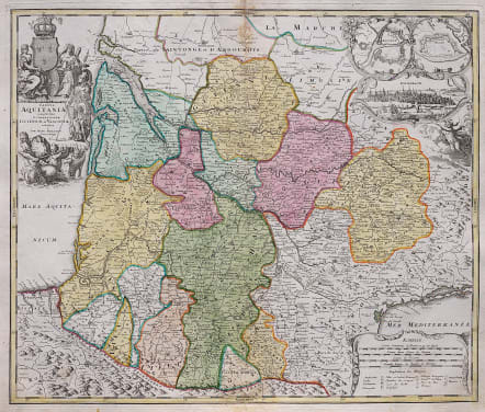
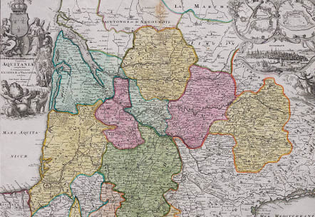
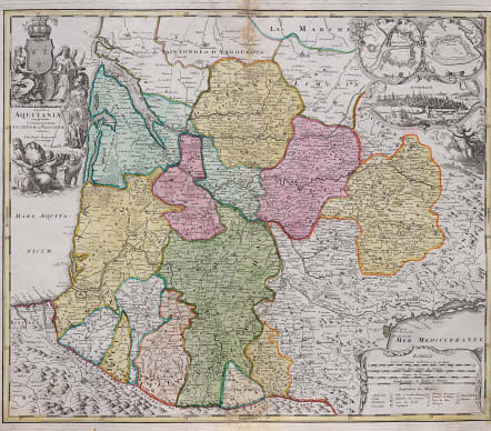
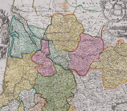
TABULA AQUITANIAE
Sold
Attractive antique map of southwest France.
Shows the former Roman province of Gallia Aquitania from Royan with the Gironde, via Bordeaux to the Pyrenees in the south and the Mediterranean in the southeast. To the top right, a splendid city view of Bordeaux, above the fortifications of Bayonne and Blaye.
Covers the areas of Dordogne, Perigord and Lot.
Decoratve cartouche.
Small stain centre top see image
Good condition.
code : M4103
Cartographer : Homann Family
Date : 1720c Nuremberg
Size : 48*57 cms
availability : Sold
Price : Sold
Johann Baptist Homann (1664-1724) started his career in Amsterdam as an apprentice with the Danckerts family before returning to Nuremberg to establish himself in business in 1702.
The firm quickly became the principal geographical publishers in Germany and in 1715 Homann was appointed Geographer to the Holy Roman Emperor and he was also a member of the Prussian Royal Academy of Sciences.
His publications included the "Neuer Atlas Ueber Die Gantze Welt ..." in 1707-. The "Grosser Atlas ..." of 1716- and the "Atlas Novus Terrarum Orbis Imperioa" in c.1720, as well as many others. Johann died in 1724 and was succeeded by his son Johann Christoph who died in 1730. After his death the firm took the name Homann's Heirs and continued thereafter until 1813. Publications with the Homann's Heirs' imprint included the "Grosser Atlas" in 1731, Doppelmays'r "Atlas Coelestis ..." in 1742 and the "Atlas Geographicus Maior ..." in 1753-, amongst others. Throughout this entire period the firm were the leading map publishers in Germany, employing a number of very important cartographers