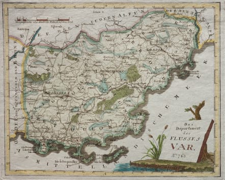
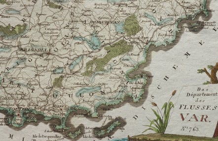
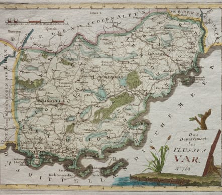
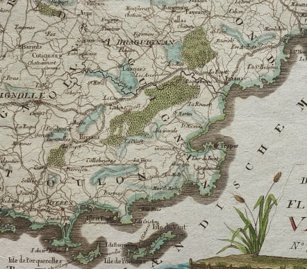
DAS DEPARTEMENT DES FLUSSES VAR
Sold
Uncommon atractive map of the Var. From Toulon to Antibes
Good map for physical features with all forests and rivers shown. The roads existing in late eighteenth century even differentiating between major and minor roads. Title held up by a tree. Excellent hand colour
Mint condition
code : M4733
Cartographer : REILLY VON Franz Johann Joseph
Date : 1789 Vienna
Size : 23*28 cms
availability : Sold
Price : Sold
Austrian born Franz Johann Joseph von Reilly (1766-1820) produced over 830 maps for his great atlas project, "Schauplatz der funf Theile der Welt" between the years 1789 and 1806. Of these 830 maps published over this time span of seventeen years, he 'showcased' but one part of the world, Europe. Maps of the other four continents remained unpublished. The maps of the "Schauplatz ..."were drawn to a uniform criteria.
Reilly's "Grosser deutscher Atlas" was also notable as the first completely 'Austrian' atlas. This large world atlas, containing relatively few maps, was issued between 1794 and the end of 1796. Reilly may have used Franz Anton Schraembl's work as his model, at least in part.