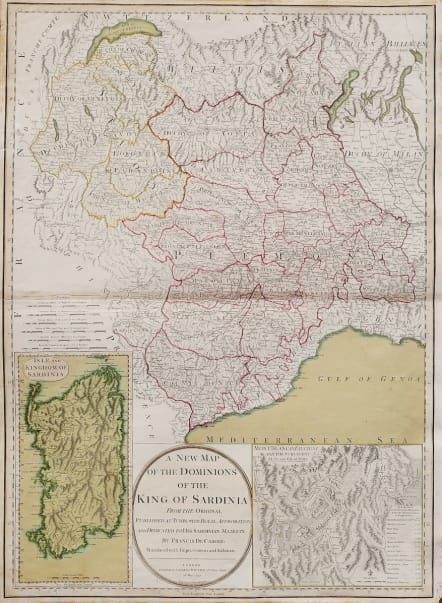
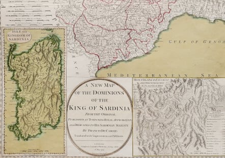
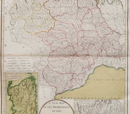
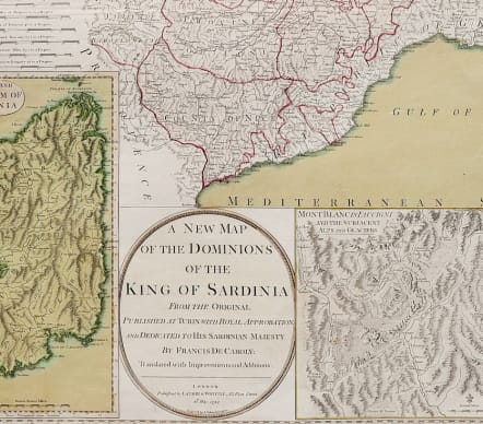
A NEW MAP OF THE DOMINIONS OF THE KING OF SARDINIA
£150
Decorative large format 18th Century map of Northwestern Italy and the region south of Lake Geneva, with a large inset of Sardinia and of the Mont Blanc area (including Glacier information) by one of England's leading map publishing firms of the late 18th Century.
The map is colored by Duchy's and shows the regions controlled by the King of Sardinia at the end of the 18th Century, centered on Turin.
The map includes a fine depiction of the major roads, towns, rivers, mountains and other topographical features. The inset gives the heights of the mountains in the Mont Blanc Region.
ORIGINAL COLOUR
Very good condition
***SPECIAL OFFER REDUCED FROM £325 to £150 ***
code : M5160
Cartographer : LAURIE & WHITTLE
Date : 1799 London
Size : 70*50.5cms
availability : Available
Price : £150