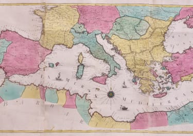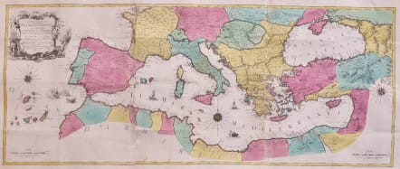
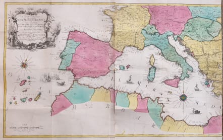
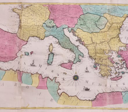
CARTE GEOGRAPHIQUE REPRESENTANT LA MER MEDITERRANEE 1770
£950
Stunning map of the Mediterranean.
Full title : "Carte Geographique representant la Mer Mediterranée ou la seconde Partie du Theatre de la Guerre entre les Russes et les Turcs C'est-à-dire les Roiaumes, les Etâts, les Provinces et les Diverses Isles situées dans la dite Mer, avec la Mer Noire ou Pont Euxine et une Partie de la Province Georgie en Asia / Par Tobie Conrad Lotter Geogr. À Augsbourg 1770".
A beautiful map of the Mediterranean Sea. Embellished with three compass roses and sailing vessels, including a scene on a naval battle in the Atlantic off of Gibraltar.
The map was printed in the middle of the Russo-Turkish War of 1768–1774. Lotter and other published provided the public with maps on which they could follow the progress of this conflict.
The Russo-Turkish War of 1768–1774 was a decisive conflict that brought Southern Ukraine, Northern Caucasus, and Crimea within the orbit of the Russian Empire.
Following the border incident at Balta, Sultan Mustafa III declared war on Russia on September 25, 1768. The Turks formed the alliance with the Polish opposition forces of the Bar Confederation, while Russia was supported by Great Britain, who offered naval advisers to the Imperial Russian Navy.
The Polish opposition was defeated by Aleksandr Suvorov. After that, he was transferred to the Turkish theatre of operations, where in 1773 and 1774 he won several minor and major battles for Russia following the previous successes of the Russian Field-Marshal Count Peter Rumiantsev at Larga and Kagul.
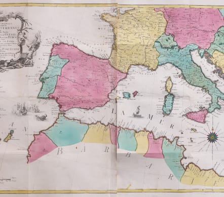
3 sheets originally canvas backed for perhaps practical use.
Original excellent hand colour. Some flattened folds
Overall very good condition.
** Advisable that your framer joins when framing
code : M5470
Cartographer : LOTTER Conrad
Date : 1770 Augsberg
Size : 53*131.5 cms
availability : Available
Price : £950
The Lotter family were and engraves and publishers based in Augsburg with a prolific output of maps in the eighteenth century.
Tobias Conrad Lotter (1717-1777) worked with Georg Matthaus Seutter (his father-in-law - he married Georg's daughter in 1740) and Tobias Lobeck. In 1756 he succeeded his father-in-law jointly with Albrecht Seutter's son and Georg Balthasar Probst, also re lated by marriage. In 1758 Lotter inherited half the copperplates of the Seutter firm and was able to set up his own, independent publishing house that same year. Some of his best known atlas works are the "Atlas Minor" (c.1744), the "Atlas Der Ganzen Welt" (1748) and the "Atlas Novus" (c.1770), as well as numerous, important, single map - the "REcens Edita Totius Novi Belgica" of c.1760 being just one of note.
The Seutter/Lotter collaboration was recognised as one of the great German publishing endeavours of the eighteenth century.
Tobias Conrad was succeeded by his sons Matthaus Albrecht Lotter and Georg Friedrich Lotter, and other family members were also involved.