

COLONIES FRANCAISES EN AMERIQUE
£55
Single-page with 4 maps of French dependencies in the Americas. Ile St. Martin and Ile St. Barthélemy, French Guiana and Suriname, Newfoundland and Saint-Pierre et Miquelon. Highly-adorned with images representing local industry, produce and customs. Descriptive text appears within the map. Original block colour(the only edition with original block colour). Published in atlas Atlas National Illustré de La France.code : M121
Cartographer : Victor
Date : 1869 Paris
Size : 29*43cms
availability : Available
Price : £55
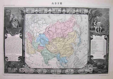
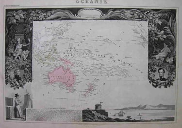
Victor Levasseur (1838–1854) was a French cartographer widely known for his distinctive decorative style. He produced numerous maps more admired for the artistic content of the scenes and data surrounding the map than for the detail of the map.

North America

£55
West Indies
£30
France
£25
France
£30
France

France

North America

£95
Europe Continent

South America

£175
World
£75
Asia
£120
Pacific & Australasia
France

North America

North America

France
