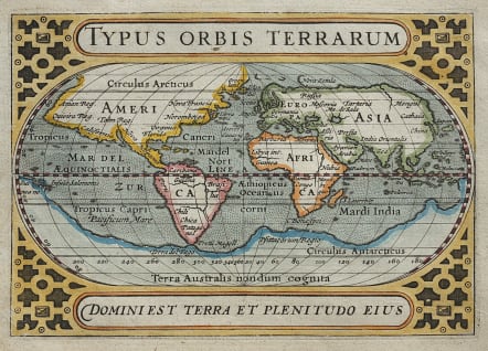
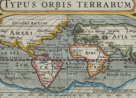
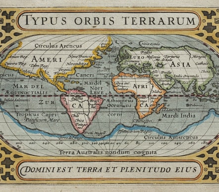
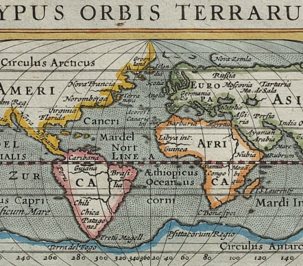
WORLD TYPUS ORBIS TERRARUM
Sold
Attractive world map on an oval projection, based on Ortelius. The large, mythical continent of Terra Australis fills the southern portion of the map, incorporating New Guinea. There are just a few place names noted in the map, including Anian, Tolm, Norumbega, Virginia and Florida. The map is similar to the one Bertius supplied for Barent Langenes' Caert-Thresoor except this plate does not contain the signature of Jodocus Hondius as the engraver. Strapwork designs fill the corners with the title above and the quote from Psalms, "Domini Est Terra Et Plenitudo Eius" (the earth is the Lord's and the fullness thereof) at bottom. Latin text on verso.
Excellent hand colour
Very good condition
Ref: Shirley #290; King (2nd ed.) pp. 96-99; Van der Krogt (Vol. III) #0001:342A.
code : M3788
Cartographer : Petrus BERTIUS
Date : 1616 Amsterdam
Size : 9.5*14 cms
availability : Sold
Price : Sold
Petrus BERTIUS
The origins of the miniature pocket atlas lie in Barent Langenes Caert Thresoor of 1598. A large number of the 169 maps were engraved by Petrus Kaerius (Van Den Keere). This small but attractive atlas was sold for the first time in 1599 by Cornelis Claesz in Amsterdam. In 1600, Claesz published the atlas with a Latin text composed by Petrus Bertius; from then on, new editions, often enlarged with new maps, regularly appeared. Petrus Bertius was born at Beveren, Flanders, in November 1565. As a refugee, Bertius settled in Amsterdam and, after finishing his studies, he became a professor of mathematics and librarian at the University of Leiden. In 1618 he also became cosmographer and historiographer to Louis XIII of France, and lived in Paris, where he died in October 1629. His fame among geographers was established by his text in the pocket atlas Tabularum Geographicarum.