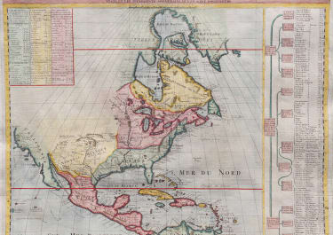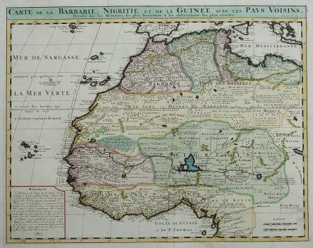
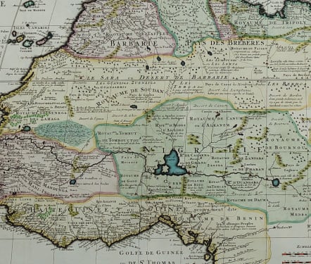
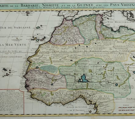
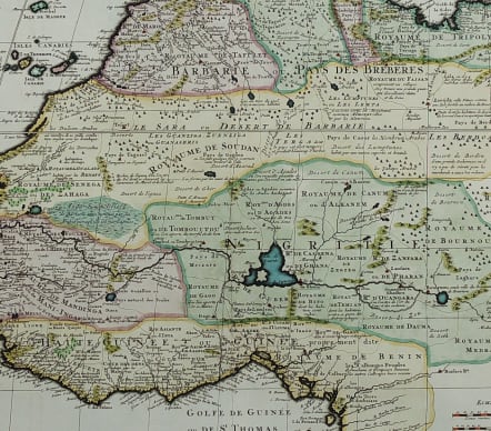
CARTE DE LA BARBERIE NEGRITIE ET DE LA GUINEE
£285
Beautiful and detailed map of West Africa based on De L'Isles map. African Kingdoms of the early eighteenth centrury are portrayed from Morocco in the northwest, to the eastern edge of Tripoly and southward and around the western edge of Africa to the Kingdom of Benin. Countless small kingdoms are noted throughout the area, as are major rivers, lakes and mountain ranges. The Sahara Desert, with the Tropic of Cancer running through its center is depicted and the myriad indigenous peoples of the area are named.
Many interesting detail such as 'here deserts and mountain passes dangerous because of theives' etc. The map is remarkably accurate and this version was used for decades by cartographers.
Excellent hand colour
Mint condition
code : M4974
Cartographer : CHATELAIN Family Henri & Zacharie
Date : 1719
Size : 40.5*51 cms
availability : Available
Price : £285
Zacharie Chatelain (d.1723) was the father of Henri Abraham (1684-1743) and Zacharie Junior (1690-1754). They worked as a partnership publishing the Atlas Historique, Ou Nouvelle Introduction A L’Histoire … under several different Chatelain imprints, depending on the Chatelain family partnerships at the time of publication. The atlas was published in seven volumes between 1705 and 1720, with a second edition appearing in 1732. The maps were accompanied by information pertaining to cosmography, geography, history, chronology, genealogy, topography, heraldry, and costume of the world.