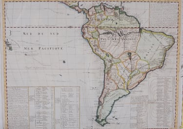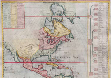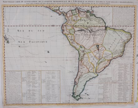
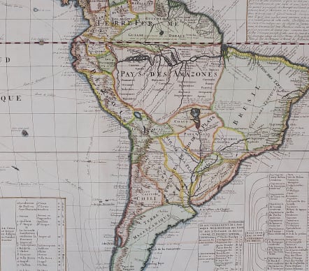
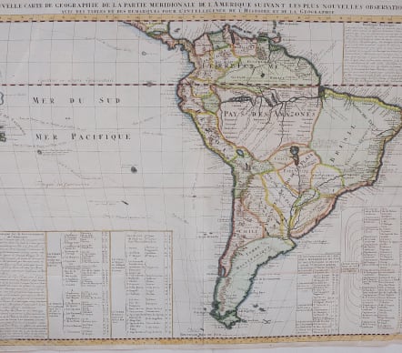

NOUVELLE CARTE DE GROGRAPHIE DE LA PARTIE MERIDIONALE DE L'AMERIQUE
£250
Attractive and detailed , large map of South America with gopious amounts of information concerning various discoveries, expeditions, and colonization. In the Pacific, the routes of Magellan, Schouten & Le Maire, Mendana & Gallego, Sarmiento and Drake are shown. Legends provide information about the political divisions and the Capitanias of Brazil. Up to date (for 1700) information on the extent of exploration in the interior.
Good Hand colour
Very good condition.
The map appeared in Chatelain's monumental Atlas Historique.
The tracks of Magellan, de la Maire, de Mendana, etc. are shown.
code : M4083
Cartographer : CHATELAIN Family Henri & Zacharie
Date : 1719 Paris
Size : 46.5 x 59.5 cms
availability : Available
Price : £250
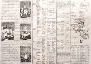
Zacharie Chatelain (d.1723) was the father of Henri Abraham (1684-1743) and Zacharie Junior (1690-1754). They worked as a partnership publishing the Atlas Historique, Ou Nouvelle Introduction A L’Histoire … under several different Chatelain imprints, depending on the Chatelain family partnerships at the time of publication. The atlas was published in seven volumes between 1705 and 1720, with a second edition appearing in 1732. The maps were accompanied by information pertaining to cosmography, geography, history, chronology, genealogy, topography, heraldry, and costume of the world.