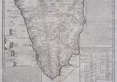
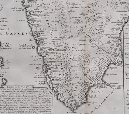
CARTE NOUVELLE DE TERRE DE CACUN DE CANARA
£85
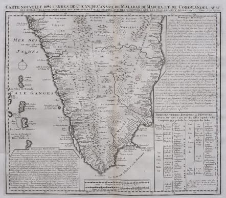
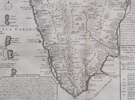
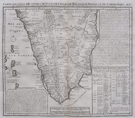
Detailed large attractive antique map of the southern portion of India by Henri Chatelain. The map was published out of Amsterdam circa 1719 as part of Chatelain’s seven volume Atlas Historique.
This map shows from Goa, Mallabar and Nelour to the southern tip of India in exceptional detail and Madras on the Coramandal coast.
The Western Ghats mountain range runs the length of the coast while hills, forests and indigenous animals are engraved throughout. Cities, villages, ports, and bays are noted along the coast while the interior includes focuses on larger cities and regional divisions. Two text boxes present the history of the area and a table presents a breakdown of the various kingdoms, capitals, and cities within each province.
Uncoloured as Issued
Very good condition
code : M5565
Cartographer : CHATELAIN Family Henri & Zacharie
Date : 1719
Size : 38*44.5 cms Sheet 46*55 cms
availability : Available
Price : £85
Zacharie Chatelain (d.1723) was the father of Henri Abraham (1684-1743) and Zacharie Junior (1690-1754). They worked as a partnership publishing the Atlas Historique, Ou Nouvelle Introduction A L’Histoire … under several different Chatelain imprints, depending on the Chatelain family partnerships at the time of publication. The atlas was published in seven volumes between 1705 and 1720, with a second edition appearing in 1732. The maps were accompanied by information pertaining to cosmography, geography, history, chronology, genealogy, topography, heraldry, and costume of the world.