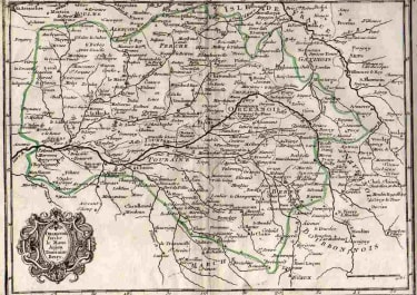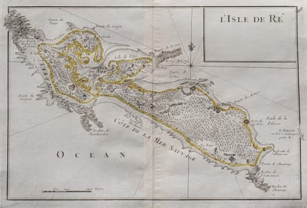
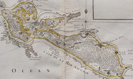
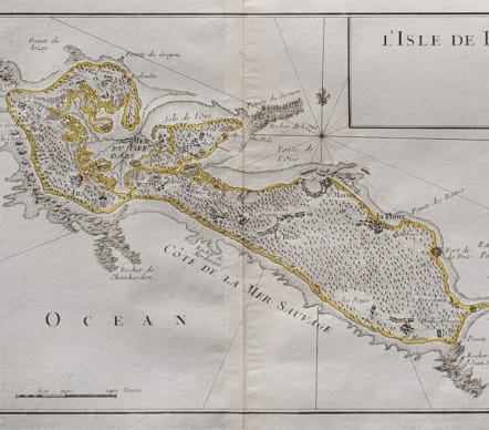
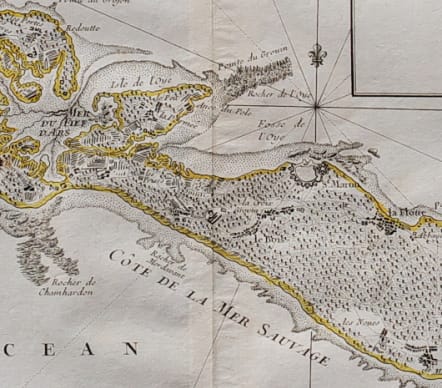
L'ISLE DE RE
£125
Detailed and attractive map of Isle de Re.
Interesting from a navigational point of view in that rocks, sand spits etc are marked. Rhum lines. Slight browning at top of centre fold.
Good hand colour
Very good condition
code : M5277
Cartographer : ROUGE LE Georges-Louis
Date : 1748 Paris
Size : 17*25 cms
availability : Available
Price : £125
Lieutenant George-Louis Le ROUGE
Lieutenant George-Louis Le Rouge (c.1712-c.1790) was born in Hanover, Germany. He became a Lieutenant in the regiment of Saxe before establishing himself as a publisher, compiler and editor of maps in Paris. He later became the “Ingenieur Geographe de Roi”.
Le Rouge is particularly known for such atlas works as the “Atlas Nouveau” of 1746 and the “Atlas Nouveau Portatif ...” or the “Introduction A La Geographie” of 1756 – French publications of some merit.
Le Rouge was initially a military “Ingenieur” for fortifications and he was also a map-maker for the army and Marine Royale. He was active between 1740 and 1780, in Paris at, rue des Augustins.