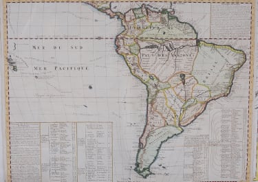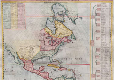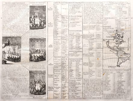
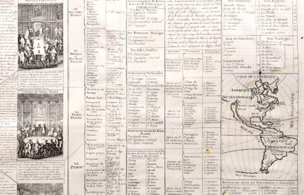
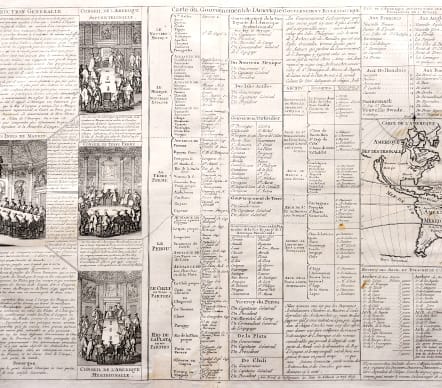
CARTE DU GOUVERNEMENT DE L'AMERIQUE
£125
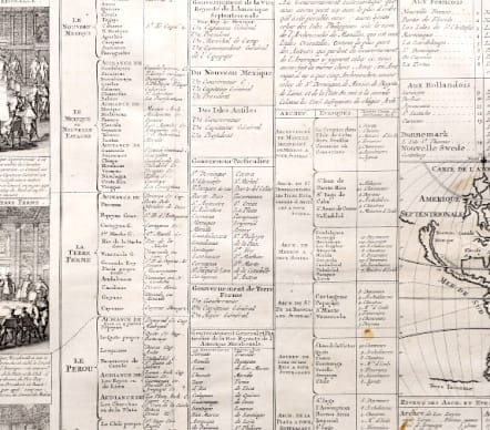
Interesting map / text depicting the European possessions and their governments in North and South America,
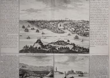
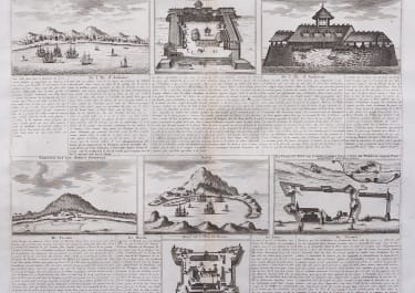
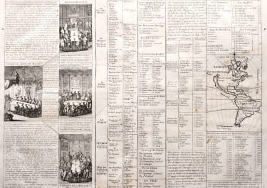
The folio sheet is filled with fascinating French text, statistics and four engravings showing the Council of the Indies dividing up Spanish Empire in America.
Small inset map of the Americas ..
California as an Island, on larger sheet, The 4 printed views of the counsels are of the West Indies, North America, South America and Terre Ferme,
Uncoloured as issued
Reinforment of centre fold bottom outside printed area
Very good condition
code : M5503
Cartographer : CHATELAIN Family Henri & Zacharie
Date : 1720 Amsterdam
Size : 34*45 cms sheet 45*52 cms
availability : Available
Price : £125
Zacharie Chatelain (d.1723) was the father of Henri Abraham (1684-1743) and Zacharie Junior (1690-1754). They worked as a partnership publishing the Atlas Historique, Ou Nouvelle Introduction A L’Histoire … under several different Chatelain imprints, depending on the Chatelain family partnerships at the time of publication. The atlas was published in seven volumes between 1705 and 1720, with a second edition appearing in 1732. The maps were accompanied by information pertaining to cosmography, geography, history, chronology, genealogy, topography, heraldry, and costume of the world.