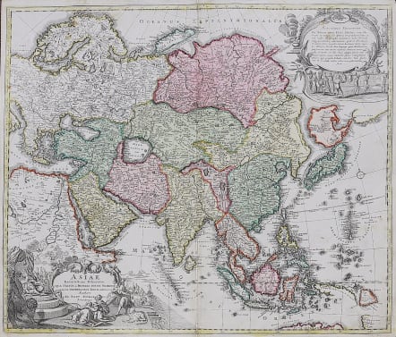
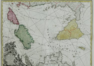
ASIAE RECENTISSIMA DELINEATIO QUA STATUS ET IMPERIA TOTIUS ORIENTIS
£495
Very attractive example of Homann's first map of Asia, extending from the Mediterranean to the Pacific and including parts of Nova Hollandia, Carpentaria, Nova Britannia and the Marianas, along with a nice incomplete version of the mythical Compagnie Land, north of Japan.
This early edition before the 'cum priviligio' of the map includes an ornate second cartouche in the upper right corner of the map. In later editions, the cartouche is removed and the coastal features above Japan along the NE Coast of Asia are significantly revised. There are also small changes in the mapping of Carpentaria.
Dampier's passage north of Carpentaria is noted, along with Arnham's Land and Vay van Diemen on the continent of Nova Hollandia. Nova Britannia appears as having been detected by William Dampier in 1700. Several place names appear in Carpentaria. Interesting projections of Japan and Corea, which appears as a long thin peninsula. Some Incognita (unknown) lands still appear in the Arctic Circle.
Very good original colour
Very good condition.
code : M3723
Cartographer : Homann
Date : 1712 Nuremberg
Size : 49*57 cms
availability : Available
Price : £495
The Family HOMANN
Johann Baptist Homann (1664-1724) started his career in Amsterdam as an apprentice with the Danckerts family before returning to Nuremberg to establish himself in business in 1702. The firm quickly became the principal geographical publishers in Germany and in 1715 Homann was appointed Geographer to the Holy Roman Emperor and he was also a member of the Prussian Royal Academy of Sciences. His publications included the “Neuer Atlas Ueber Die Gantze Welt ...” in 1707-. The “Grosser Atlas ...” of 1716- and the “Atlas Novus Terrarum Orbis Imperioa” in c.1720, as well as many others. Johann died in 1724 and was succeeded by his son Johann Christoph who died in 1730. After his death the firm took the name Homann’s Heirs and continued thereafter until 1813. Publications with the Homann’s Heirs’ imprint included the “Grosser Atlas” in 1731, Doppelmays’r “Atlas Coelestis ...” in 1742 and the “Atlas Geographicus Maior ...” in 1753-, amongst others. Throughout this entire period the firm were the leading map publishers in Germany, employing a number of very important cartographers

