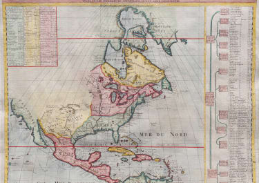
NOUVELLE CARTE DE L'AMERIQUE SEPTENTRIONALE DRESSEE SUR LES PLUS NOUVELLES OBSERVATIONS
£565
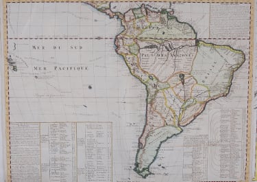
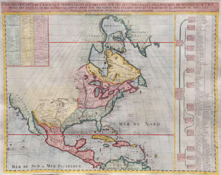
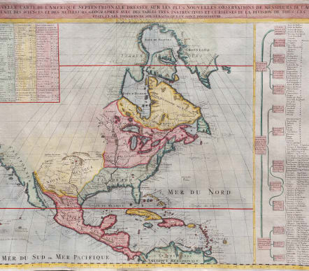
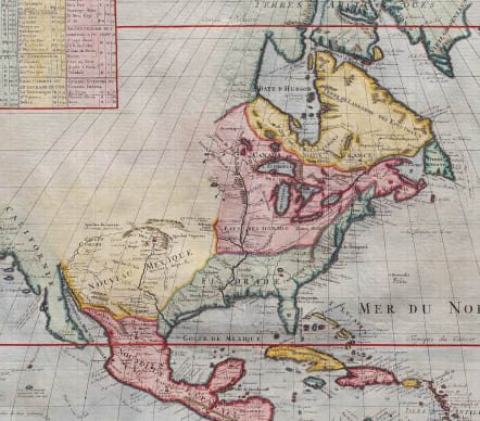
Nouvelle Carte de l' Amerique Septentrionale Dressee sur les plus Nouvelles Observations de Messieurs de l' Academie
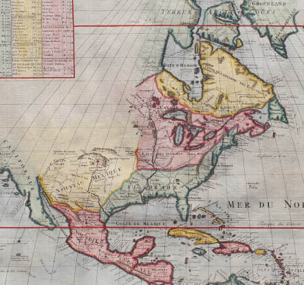
Stunning map of North America published by Henry Chatelain for the 1720 edition of his seminal Atlas Historique. Some of the first well developed cartography of the Great Lakes region and considerable detail along the eastern seaboard. Indian tribes, Spanish missions, and explorer routes are all indicated with varying degrees of accuracy.Includes references to several mythical kingdoms and cities including Quivra (Quivira) just west of the Mississippi, and Cibola in New Mexico.
As expected, the political situation was depicted from the perspective of a Francophile, with English claims minimized by a large Spanish Florida and Nouvelle France. The Appalachian Mountains are shown crowding British Territory to the East Coast, while much of the interior of the continent is shown open for settlement.
California is shown as a peninsula with a number of villages and mountains; the Mississippi River extends far north of its true source.
Table on right namin the indigenous tribes in some detail.
An interestin map of it's ime with excellent hand colour
Very good condition
code : M5579
Cartographer : CHATELAIN Family Henri & Zacharie
Date : 1719 Amsterdam
Size : 47.5*59 cms
availability : Available
Price : £565
Zacharie Chatelain (d.1723) was the father of Henri Abraham (1684-1743) and Zacharie Junior (1690-1754). They worked as a partnership publishing the Atlas Historique, Ou Nouvelle Introduction A L’Histoire … under several different Chatelain imprints, depending on the Chatelain family partnerships at the time of publication. The atlas was published in seven volumes between 1705 and 1720, with a second edition appearing in 1732. The maps were accompanied by information pertaining to cosmography, geography, history, chronology, genealogy, topography, heraldry, and costume of the world.