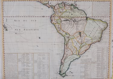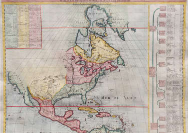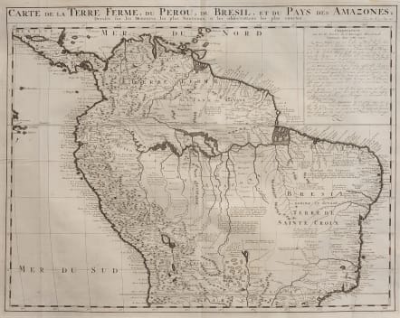
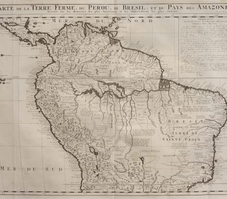
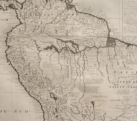
CARTE DE LA TERRE FERME DU PEROU DU BRESIL ET DU PAYS DES AMAZONS
£295
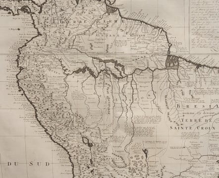
Detailed early map of the Amazon running through Columbia; Ecuador, Peru and Brazil. Attempt to name as many places as possible and fill in with indigeonous tribes that were known.
Really quite a good attempt to show on a commercial map the Amazon River and the towns and peoples thazt lived there.
This handsome map of the northern part of South America based on the cartography of Guillaume Delisle.
It is filled with place names and notations speculating about the Indian tribes and the tributaries of the Amazon. The Capitanias are named in Brazil and the Inca Way is shown from Chuquisaca in Peru to Pasto in Colombia.
Title at top with text block at upper right.
Contains some explicative text in the upper right corner, giving information about the 4 main areas delineated in the map.
A good and dark impressionin very good condition
code : M4720
Cartographer : CHATELAIN Family Henri & Zacharie
Date : 1719
Size : 49*52 cms
availability : Available
Price : £295
Zacharie Chatelain (d.1723) was the father of Henri Abraham (1684-1743) and Zacharie Junior (1690-1754). They worked as a partnership publishing the Atlas Historique, Ou Nouvelle Introduction A L’Histoire … under several different Chatelain imprints, depending on the Chatelain family partnerships at the time of publication. The atlas was published in seven volumes between 1705 and 1720, with a second edition appearing in 1732. The maps were accompanied by information pertaining to cosmography, geography, history, chronology, genealogy, topography, heraldry, and costume of the world.