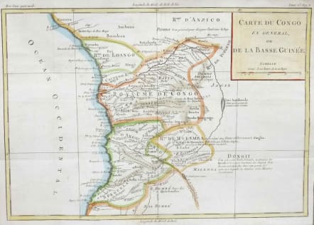
CONGO CARTE DE CONGO
Sold
Intersting and attractive map of the Congo area. Many place and tribal names. Good hand colour.
Very good condition
REF: Histoire Universelle
code : M2796
Cartographer : VAUGONDY ROBERT DE Family
Date : 1779 Paris
Size : 24*34.5 cms
availability : Sold
Price : Sold
The Robert de Vaugondy family responsible for map and globe publishing in Paris comprised Gilles Robert de Vaugondy (1688-1766) and Didier Robert de Vaugondy (1723-1786). The father (Gilles) and son (Didier) business flourished from 1731 to 1778.
Prominent at this time among French map-makers were the Robert de Vaugondy family, who made a substantial contribution to the eighteenth century world of cartography, through the breadth and success of their prolific output, which included atlases, maps, globes and book illustration.
While only a small part of their output, the "Atlas Universel" encapsulates the diligent and scientific approach adopted by the Roberts de Vaugondy, and proved to be the most successful French world atlas of the period. It appeared from c.1757 onwards.