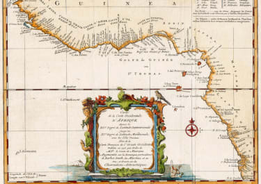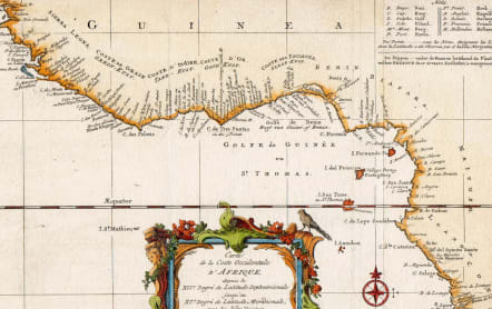
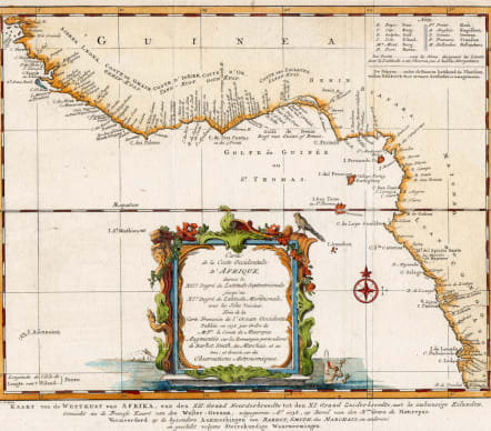
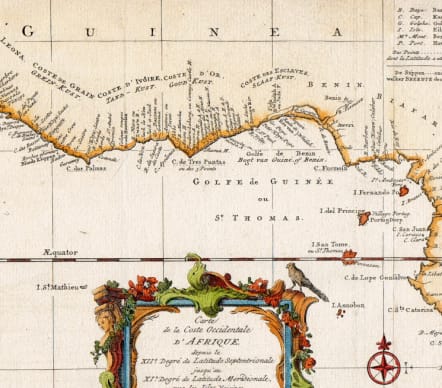
CARTE DE LA COSTE OCCIDENTALE D'AFRIQUE
£100
Interesting and very detailed map of the region from Sierra Leone to Luanda. This early Dutch edition ( with dutch text under bottom of map ) has a much more ornate & decorative cartouche than the later and more comon Bellin editions. The rococo carouche contains a bird perched on top and Poseidon in sea.
This rare Dutch version of the Golfe de Guinee is in mint condition with excellent hand colour.
Only version of this map I can find is at the Smithsonian
https://sova.si.edu/record/eepa.1991-001/ref52
code : M5608
Cartographer : Jacques-Nicolas BELLIN
Date : 1738 Paris
Size : 21*25 cms sheet size 24.5*37 cms
availability : Available
Price : £100
Jacques-Nicolas Bellin (1703-1772) was one of the most important and prolific French cartographers of the mid-eighteenth century, in the service of the French Hydrographical Office. He was appointed the first Ingenieur Hydrographe de la Marine, and also Official Hydrographer to the French King.
Bellin was responsible for an enormous output of charts and maps. In a large folio format, he issued a volume of sea-charts of France, the Neptune Francois, and several sea-atlases of the World, including the Atlas Maritime and the Hydrographie Francaise. These large charts were amongst the best of the period and continued being reissued throughout the second half of the eighteenth century.
In smaller format, he issued the Petit Atlas Maritime (1764),which contained 580 detailed charts, as well as maps to illustrate l'Abbe Prevost's Histoire Generale des Voyages (1746-1757). Bellin also produced a substantial number of important separately issued maps, particularly reflecting continuing discoveries and political events in the Americas.