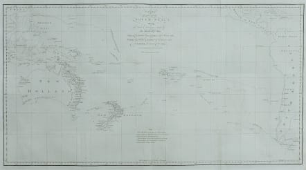
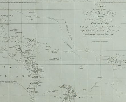
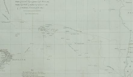
CHART OF THE SOUTH SEA SHEWING THE TRACTS..DOLPHINN ENDEAVOUR LIEUTENANT COOK 1769
Sold
Full title::
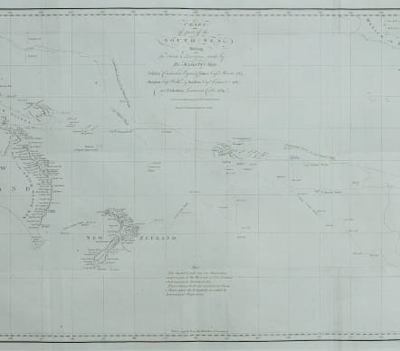
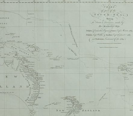
Chart of part of the South Sea, Shewing the Tracts and Discoveries made by His Majesty's Ships, Dolphin, Commodore Byron, & Tamer, Capt.n Mouat, 1765. Dolphin, Capt.n Wallis, & Swallow, Capt.n Carteret, 1767, and Endeavour, Lieutenant Cooke, 1769
Scarce first edition of Cooks first voyage. Shows the tracks of the important dicoveries by 5 Voyages, with Captains, ships & tracks are;
1. 1764-66 - HMS Dolphin under Command of Commodore John Byron, completed the first circumnavigation of the globe under two years.
2. 1764-1766 - HMS Tamar under Command of Captain Patrick Mouat, accompanied Commodore John Byron & HMS Dolphin on 1764-66 circumnavigation of the world.
3. 1766-68 - HMS Dolphin under Command of Captain Samuel Wallis, completed another circumnavigation & was the first European to visit Tahiti & the Society Islands.
4. 1766-68 - HMS Swallow under Command of Captain Philip Carteret, who accompanied HMS Dolphin under the command of Samuel Wallis to circumnavigate the world.
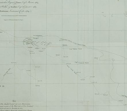
5. 1769-71 - HMS Endeavour, under Command of Lieutenant James Cook (later Captain) completed a the mapping of Tahiti & the Society Islands, New Zealand & the East Coast of Australia.
First edition of Cook's chart of the South Pacific, engraved by William Whitchurch for the Official Account of Cook's First Voyage, which appeared in Hawkesworth's Account of the Voyages.
Cook's route across the South Pacific from Cape Horn to New Zealand and Australia is clearly marked.
As per issue Folds flattened
Very good condition for this important map.
* Important map of Australia at this time.
Chart from: An account of the voyages undertaken ... in the southern hemisphere ... / John Hawkesworth. London: W. Strahan & T. Cadell, 1773.
code : M5027
Cartographer : ANON
Date : 1773 London
Size : 37*65.5 cms
availability : Sold
Price : Sold