


ARCHIPEL DES INDES ORIENTALES
£475
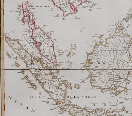
Attractive and very detailed large map of the region from Sumatra and Malaca and Southern China to the Philippines, New Guinea and Northern Australia, centered on Borneo.
Includes a large inset of the Marianas. New Guinea is also inaccurately represented.
Original outline colour
Printed on good heavy paper
Excellent condition
code : M4060
Cartographer : VAUGONDY ROBERT DE Family
Date : 1750 Paris
Size : 52.0 x 62.5cms
availability : Available
Price : £475
The Robert de Vaugondy family responsible for map and globe publishing in Paris comprised Gilles Robert de Vaugondy (1688-1766) and Didier Robert de Vaugondy (1723-1786). The father (Gilles) and son (Didier) business flourished from 1731 to 1778.
Prominent at this time among French map-makers were the Robert de Vaugondy family, who made a substantial contribution to the eighteenth century world of cartography, through the breadth and success of their prolific output, which included atlases, maps, globes and book illustration.
While only a small part of their output, the "Atlas Universel" encapsulates the diligent and scientific approach adopted by the Roberts de Vaugondy, and proved to be the most successful French world atlas of the period. It appeared from c.1757 onwards.


