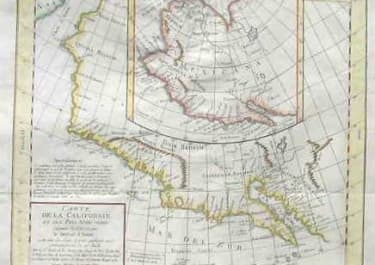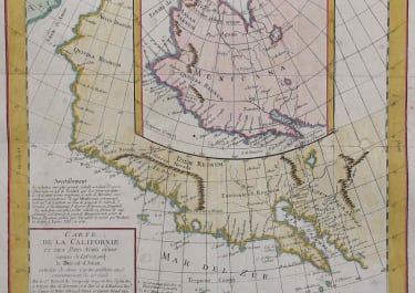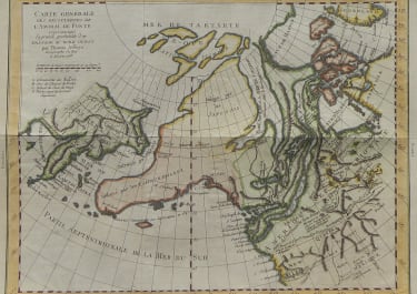
CARTE DE LA CALIFORNIE SUIVANT ...
£550
Title : Carte de la Californie suivant / I. La carte manuscrite de l'Amérique de Mathieu Néron Pecci olen dresse à Florence en 1604 / II. Sanson 1656 / III. De L'Isle Amérique Sept. 1700 / IV. le Pere Kino Jesuite en 1705 / V. La Societe des Jésuites en 1767.
Survey of the Fine Early Maps of California
A historically important depiction of the 5 most influential cartographic depictions of California, showing the evolution of how California was mapped between 1604 and 1767.
1.The earliest map is (upper right corner) based upon a manuscript map by Mathieu Neron Pecci, drawn in Florence in 1604. This map also forms the basis of a map popularized in 1770 by Rigobert Bonne.
2.The second map is Nicholas Sanson's map of California as an Island, based upon his larger map of 1656. This map was probably the single most influential projection of California as an Island.
3.The third map (lower right) is a portion of Guillaume De L'Isles map of America, published in 1700. While not truly peninsular in nature, it was influential in the shift back toward depicting California as a Peninsula.
4.The fourth map (upper center) is a portion of Fra. Eusebio Kino's map, generally credited with being the map which dispelled California as an Island myth. Issued in 1705, the map is based upon Father Kino's overland expedition from the mainland to the top of the Gulf of Cortez.
5.The fifth map is one of the most interesting and enduring maps of California and Baja (left side). Initially issued by the Society of Jesuits in 1767, it was popularized by Isaak Tirion and was perhaps the most interesting of all maps of Baja California in the 2nd half of the 18th century.
An essential map for California collectors.
Excellent hand colour
Very good condition
code : M5191
Cartographer : VAUGONDY ROBERT DE Family
Date : 1772 Paris
Size : 31*40 cms
availability : Available
Price : £550
The Robert de Vaugondy family responsible for map and globe publishing in Paris comprised Gilles Robert de Vaugondy (1688-1766) and Didier Robert de Vaugondy (1723-1786). The father (Gilles) and son (Didier) business flourished from 1731 to 1778.
Prominent at this time among French map-makers were the Robert de Vaugondy family, who made a substantial contribution to the eighteenth century world of cartography, through the breadth and success of their prolific output, which included atlases, maps, globes and book illustration.
While only a small part of their output, the "Atlas Universel" encapsulates the diligent and scientific approach adopted by the Roberts de Vaugondy, and proved to be the most successful French world atlas of the period. It appeared from c.1757 onwards.


